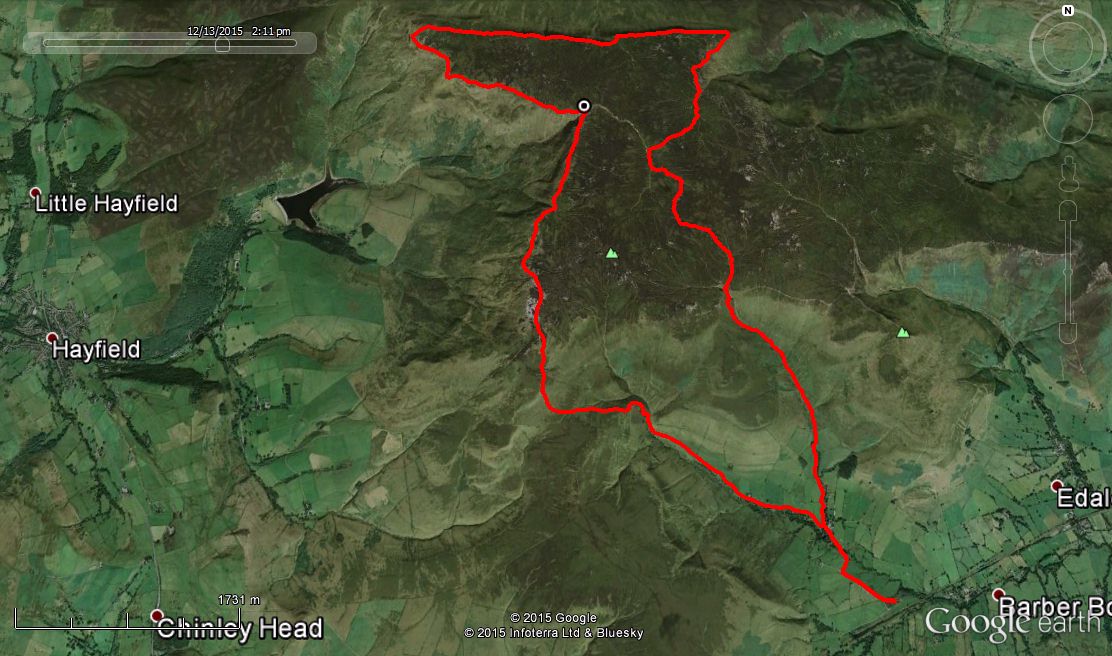
Steve’s instructions were: “Meet at free parking along the Upper Booth road, Edale (GR:107847) for a prompt 9:30 start. Route goes via Crowden Brook, Kinder River, Fairbrook Naze, Ashop Edge, the Downfall and Kinder Low. Approx 12 miles. No cafes or pubs along the way so come prepared!”
Unfortunately, Steve was unwell so I “stepped in” as the meet coordinator and tried to follow his instructions to the letter. I’m sure that some of the team could have walked the route in their sleep and I ended up leading from the rear for parts of the day.
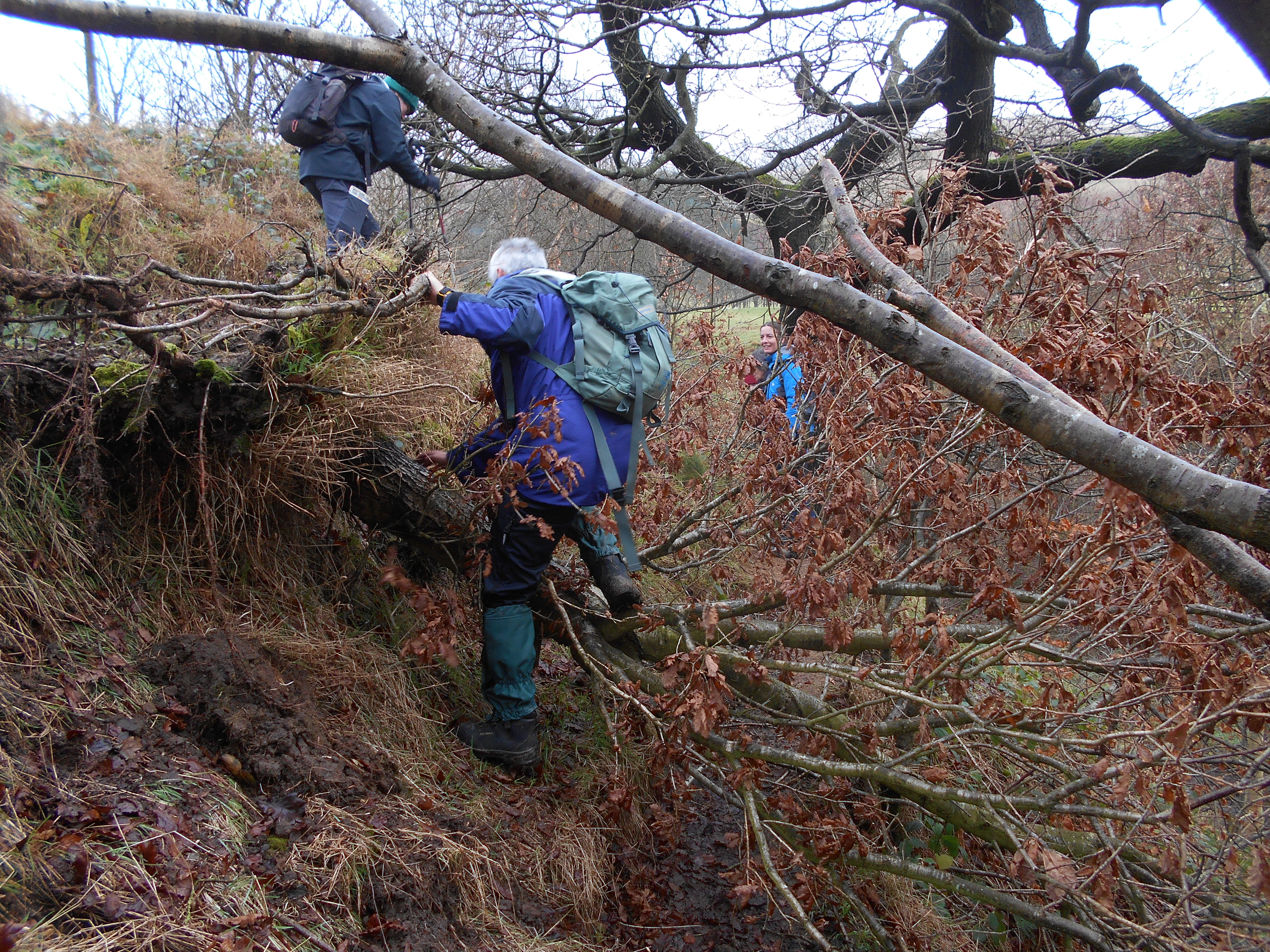
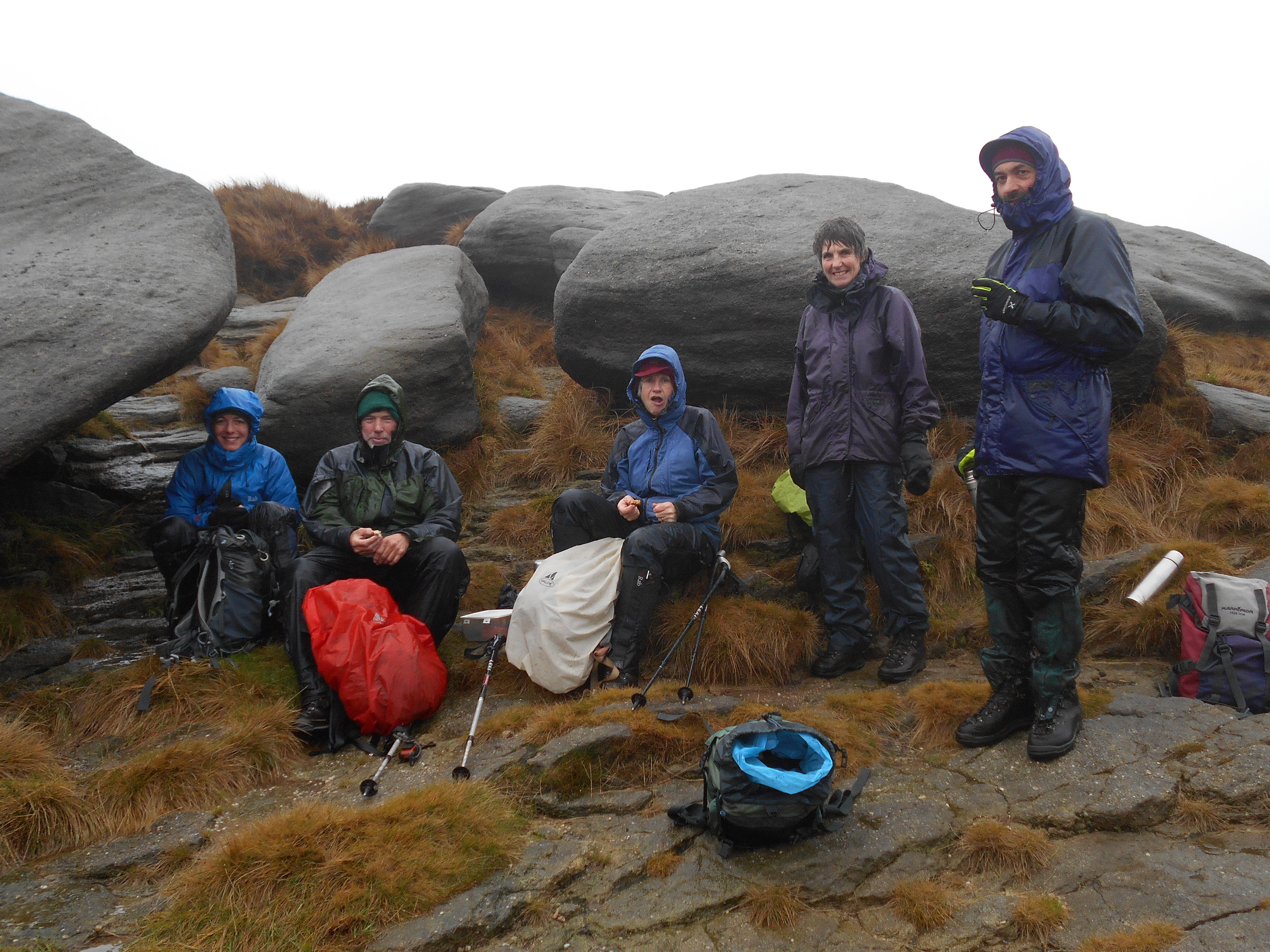
Steve had not mentioned mist, drizzle, sleet or more persistent rain but we encountered all at times. Conditions were understandably wet underfoot, but not excessively so. The recent winds had blown over a tree in Crowden Clough soon after the start which we had to climb through . We opted not to scramble up Crowden Brook itself due to the volume of water in it and were soon at plateau level heading almost due north for Fairbrook Naze. If you have not been on Kinder or Bleaklow for a few years you will be amazed – green with new grass rather than black with peat. We found the Kinder River but possibly followed it too far as the Kinder Gates came into view, so a change in bearing soon brought us to the northern plateau edge. Andy’s GPS track shows a bit of a sinuous shimmy in the middle of the plateau, but I say you need to weave a little to get into the right drainage system!
Following a coffee break/early lunch we pressed on westwards along the edge of the plateau to the Pennine Way and a sharp turn to the the south east and thence Kinder Downfall and lunch part II. From here it was the trig. on Kinder Low and a descent of Jacobs Ladder, returning to the cars just as it got dark. 12.1 miles on the GPS.
A good day out – thanks to all those who came, especially to Janet who was on her first non-climbing meet.
David
Submit a CommentPlease be polite. We appreciate that.