Home › Forums › Messages click here › Thursday Walk March 20th
- This topic has 2 replies, 1 voice, and was last updated 1 year, 2 months ago by
Dick Murton.
-
AuthorPosts
-
March 13, 2025 at 8:01 pm #23834
Dick Murton
ParticipantMeet in carpark, GR SK194647, just off Long Rake at normal time. Outline route – Calling Low, Lathkill Dale starting near One Ash Grange Farm, Conksbury village, Youlgrave, Bradford Dale and back to the car park. About 7.7 miles, 500 ft ascent
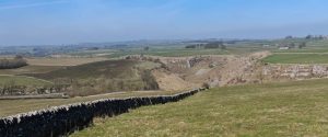
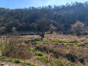
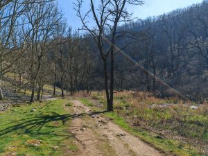
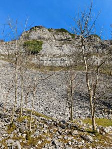
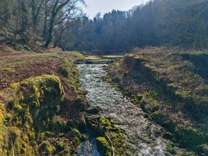
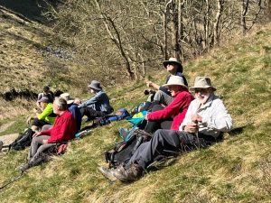
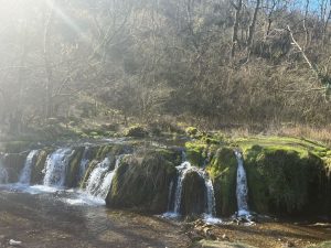
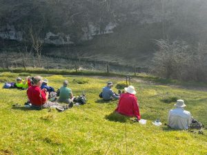
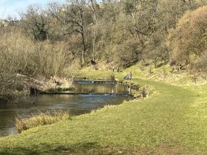
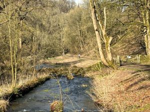
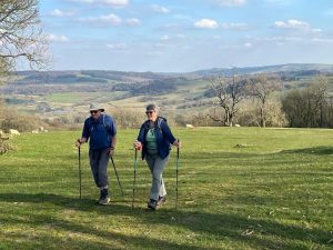
March 20, 2025 at 6:58 pm #23853ParticipantThe sun god Ra was feeling benevolent today, so in sun and warmth, 4 met up in what turned out to now be a pay & display, with the other 4 parking at the nearby free layby! Setting off towards Lathkill Dale, we were followed by at least three other couples, making it look as if it was going to be an overpopulated walk. Coffee was taken at the junction of Cales Dale and Lathkill Dale, fortunately early enough to finish just after a large school group from Leicester stopped there for lunch. We continued down Lathkill Dale, to Raper bridge and then to Youlgr(e)ave. A loo stop for a few, and then down into Bradford Dale, returning to the cars via Weadlow lane and paths. Distance? Somewhere a bit over 7 miles with about 1000 ft ascent. It is interesting how different models of GPS and the associated logging setup can make such a difference to the distance logged. Everyone had a different distance, and presumably ascent/descent. Thanks everyone for very pleasant day out.
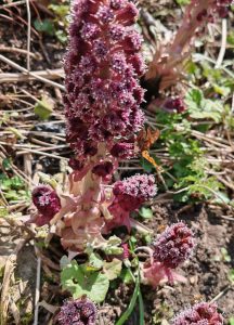
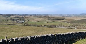
March 20, 2025 at 7:02 pm #23854ParticipantThe sun god Ra was feeling benevolent today, so in sun and warmth, 4 met up in what turned out to now be a pay & display, with the other 4 parking at the nearby free layby! Setting off towards Lathkill Dale, we were followed by at least three other couples, making it look as if it was going to be an overpopulated walk. Coffee was taken at the junction of Cales Dale and Lathkill Dale, fortunately early enough to finish just after a large school group from Leicester stopped there for lunch. We continued down Lathkill Dale, to Raper bridge and then to Youlgr(e)ave. Brimstone and Red Admiral butterflies were noted out in force. A loo stop for a few, and then down into Bradford Dale, returning to the cars via Weadlow lane and paths. Distance? Somewhere a bit over 7 miles with about 1000 ft ascent. It is interesting how different models of GPS and the associated logging setup can make such a difference to the distance logged. Everyone had a different distance, and presumably ascent/descent. Thanks everyone for very pleasant day out.
Dave’s pics:
Pete’s pics:
-
AuthorPosts


- You must be logged in to reply to this topic.