Ten members and a potential new member started from Fairholmes.
The weather was good and warm in spite of a slight breeze from
the north. We took the road below Derwent Dam to Derwent.
The low level of water in Ladybower Reservoir meant we
could see several old walls from the drowned village. We
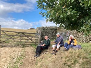
climbed the steep path up to Lanehead Farm and paused for
a coffee break by the wall at the top of the next field.
From this spot we had a great view to the south over
Ladybower Reservoir to Win Hill, Mam Tor etc., and eastward
to Derwent Edge. A buzzard flew nearby. Snack over, we
continued the ascent but the gradient soon eased as we
passed to the east of Pike Low. We reached the highest point
of the walk and began to descend. One couple took a shorter
option by descending from the path junction before the ruins
of Bamford House. The remaining nine continued to Abbey Bank
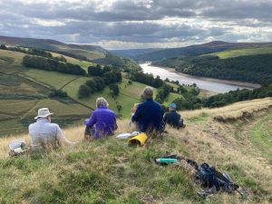
where we had our picnic lunch on a heather covered perch
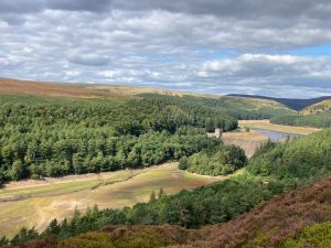
where we could look towards Howden Dam and Howden Reservoir
behind it. We remarked that the water level was the lowest
we had ever seen. No water could be seen past the first bend
and the exposed banks were green. (The Severn Trent website
recorded only 12% of its full capacity on 12th September). A
couple of peregrines flew overhead. Once our leisurely
picnic was over, we headed down through Abbey Tip Plantation
to join the track along the eastern side of Derwent
Reservoir, which we followed back to Derwent Dam. Drilling
was taking place at the base of the dam in connection with
the planned expansion of the reservoir by raising the height
of the dam. A couple of twin-rotor military helicopters flew
low over our heads. We returned to the start, where the
recorded distance was 6.0 miles and the ascent 1040 ft.
Andy & Rosy
Pete’s pictures:


