All posts in Meet Reports

Meet report from Kial’s Wildboar Clough Scramble 23/1/22

8 of us met at Torside reservoir carpark to find the parking God firmly on our side – the ticket machine being out of order meant free parking all round 😊
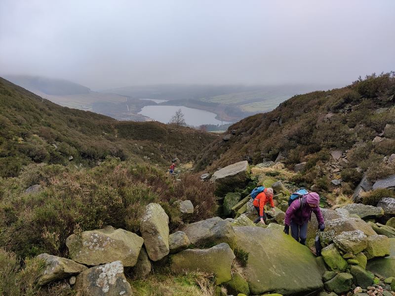
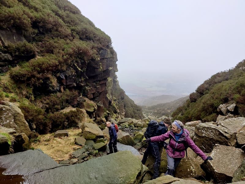
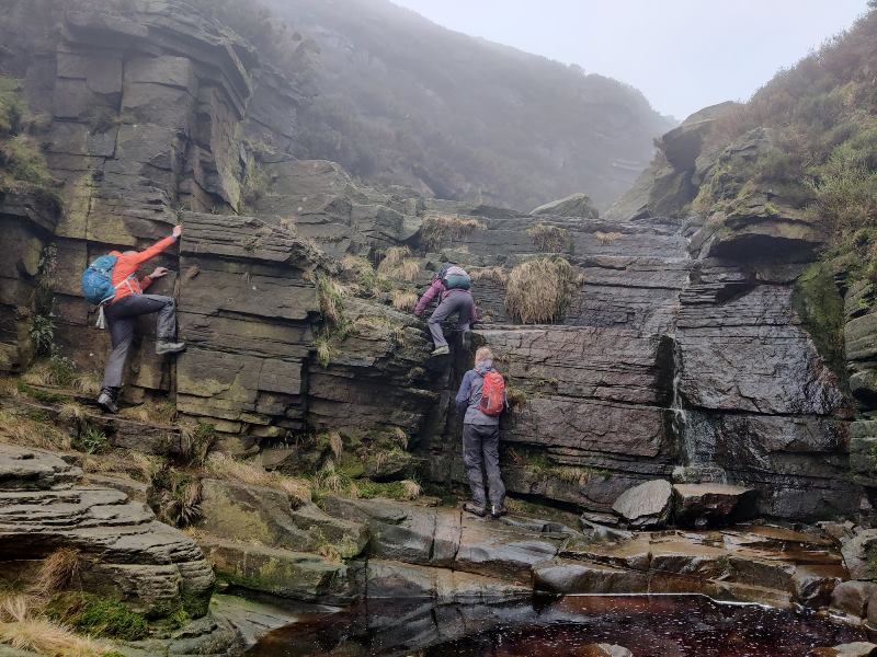
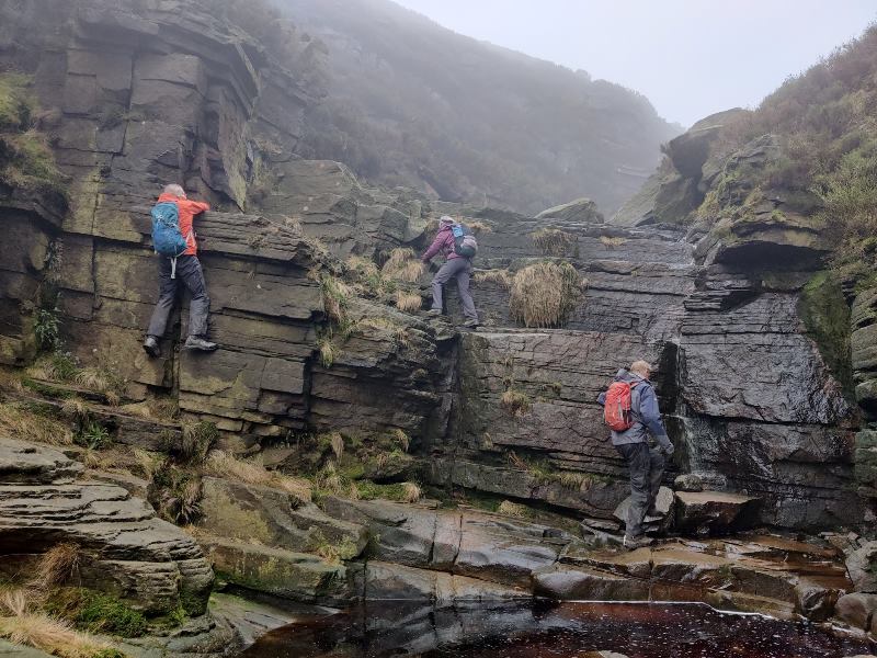
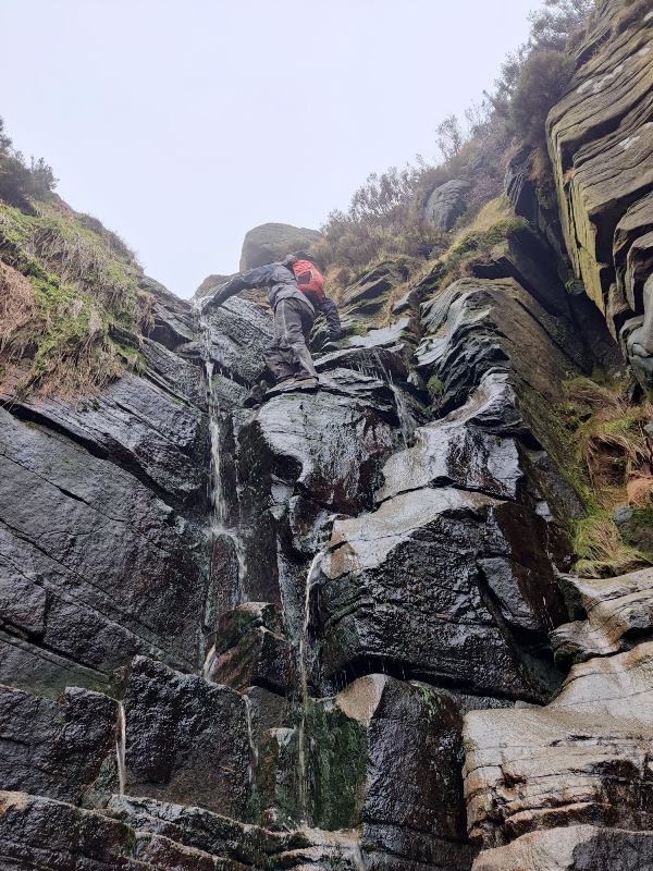
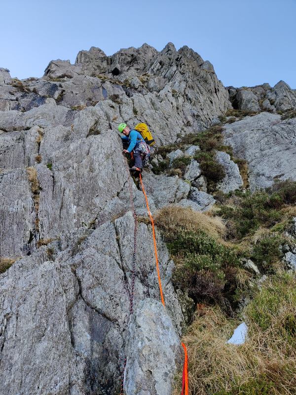
We set-off at a leisurely pace along the Trans Pennine Trail before heading off into woodland to join the bottom of Wildboar Clough. With very little water flowing we found ourselves deep in the middle of the riverbed hoping across moss covered rocks. We soon arrived at the first major obstacle with each of us finding a different route up the waterfall, Bill taking the direct line and straight up the flowing water!
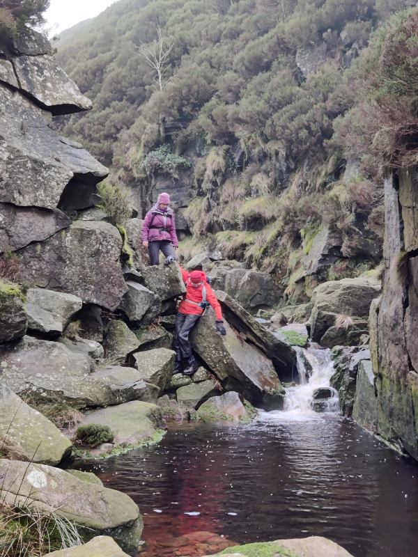
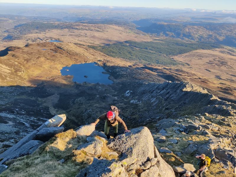
Several waterfalls later and only the odd damp foot we made it to the top of the clough and headed across moorland to pick up the Pennie Way.
We followed this for a couple of miles before heading West towards the B29 crash site (the whole of Sheffield seemed to have had the same idea, all blindly following there mobile phones) and then to the trig point at Higher Shelf Stones. From here we followed the path West before cutting across moorland, heading North towards Yellowslacks Brook which provided a welcome lunch stop.
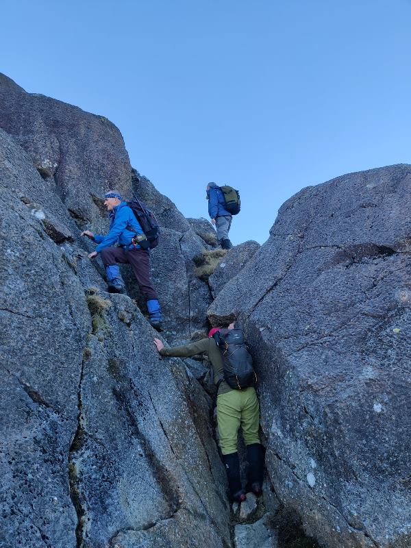
We followed this to Wain Stones and then on a compass bearing headed across moorland to pick up the Pennine Way at the top of Torside Clough.
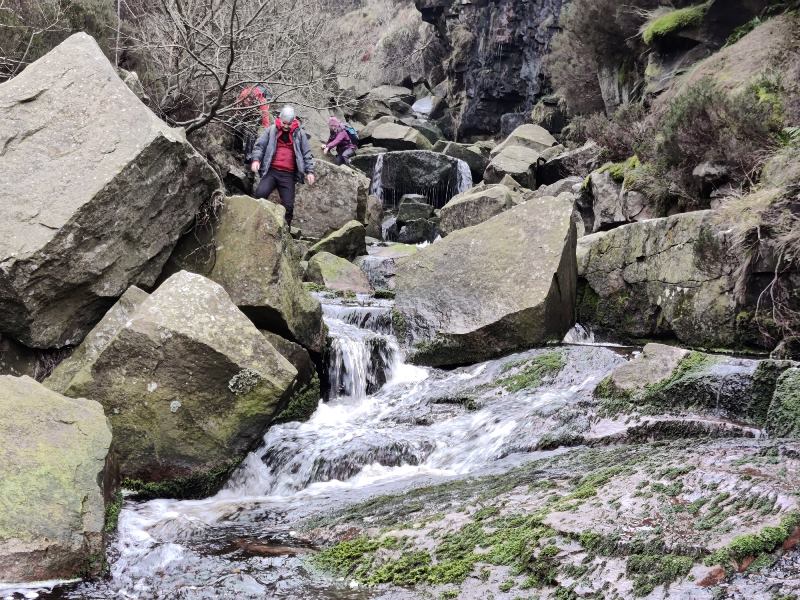
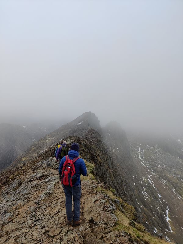
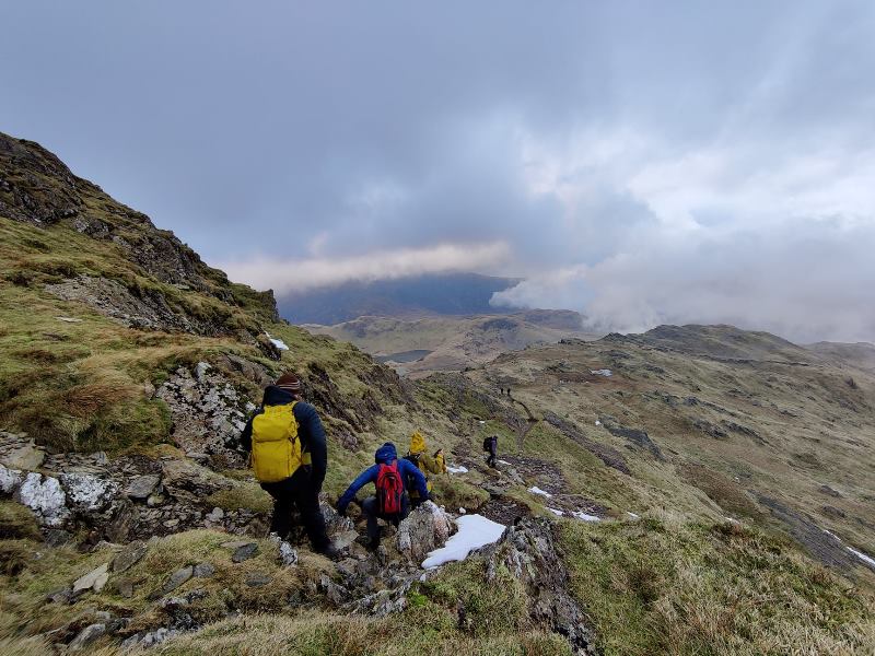
We split up at this point with 3 members opting for the quick way back down the Pennine Way while the rest of us did more rock hoping, stream crossing and scrambling down Torside Clough. We then picked up the Pennine Way and followed this back down to the Trans Pennine Trail and the flat walk back to the carpark.
11.5 miles covered in a thoroughly enjoyable day, thanks to everyone that turned up.
Kial
P.S photos on facebook via this link
https://www.facebook.com/groups/365080970512881/permalink/1573575146330118/


North Wales long weekend 13th to 16th January 2022

North Wales Meet Report:
6 of us meet at Capel Curig Thursday morning and set off past the impressive gorge of Afon Llugwy and headed up to the disused quarry on route to Moel Siabod. Although the weather was clear and sunny it wasn’t hot enough to tempt any of us to take a dip in the water pool crater of the quarry!
After a quick coffee stop, we pressed on to reach the southeast ridge of Daear Ddu and the start of the scramble up warm rock to the summit of Moel Siabod where we enjoyed the views across to Snowdon and Tryfan, both looking impressive with the clear blue-sky backdrop.
After a quick bite to eat we headed back down the northeast ridge to pick up the outbound path back at the disused quarry.
We then all headed over to Coetmor Mill to unload our gear and claim a bunk. The rest of the evening was then spent pondering over the next days activities.
Friday saw us splint into 3 groups. One group headed out to Foel-fras taking in Foel-ganol, Pen Bryn-do and Llwytmor on this circular walk. Llwtmor providing stunning vistas over Anglesey.
The other two groups opted to go climbing, one group heading over to Tremadog and the other opting for Grooved Arete on Tryfan which turned out to be elusive to find with climbing not starting until after lunch. The climb was topped out just as the sun was falling below the surrounding mountains leaving us to don headtorches to find the route back down the mountain, arriving back at the digs close to 9pm!
Friday evening also saw the arrival of the remaining 5 members, growing our number to 11.
Saturday we split into two groups with 6 people heading out for a walk straight from the hut taking in Moel Faben, Ilefn, Gyrn, Drosgl & Gyrn Wigau.
The remaining 5 headed over to Snowdon. Leaving the masses behind on the Pyg Track from Pen-y-pass we headed up to Crib Goch, scrambling along the ridge to Garnedd Ugain and then to the summit of Snowdon. After a spot of lunch we headed back down the Watkin Path to Bwlch Ciliau then continuing along the ridge line to Y Lliwedd and descending down to Llyn Llydaw reservoir where Matt couldn’t resist a quick swim with many cheers from passes-byes. Then a quick walk along the Miners Track to complete the circular route around the Snowdon horseshoe.
Saturday evening proved to be very sociable with us all contributing to cooking up a communal curry and a few drinks.
Sunday the weather finally let us down, turning wet and windy. We all went our separate ways, some heading straight home while a couple of brave souls headed up to Glyder Fawr via Bwlch Tryfan & Glyder Fach and returning via Devils Kitchen.
A great weekend was had by all, photos on Facebook page here:
https://www.facebook.com/castlemountaineering/posts/155162610184070
Kial Wright

Southeast ridge of Daear Ddu

Approaching the summit of Moel Siabod

Summit of Moel Siabod

First pitch of Grooved Arete, Tryfan

Pitch 5 of Grooved Arete, Tryfan

Crib Goch ridge

On Snowdon

Report on Sunday 16th January 2022 walk

Five of us gathered in Monyash carpark at 10 am on a slightly misty morning, before heading out on initially familiar paths and tracks, to join the Pennine Bridleway heading northwest, south of Pomeroy and under two bridges [not marked in my White Peak map book, for some reason]. After crossing the main A515 Buxton to Ashbourne road, we then walked along unfamiliar tracks with distant views out to the east, meeting quad bikes, cyclists, joggers and dog walkers. Skirting the Sough Top trig point, we dropped down towards Taddington, looking for a suitable lunch spot out of the cool wind. After lunch, on the southern outskirts of Taddington where 5 footpaths meet [always a confusing challenge on an un-recced walk] we were rewarded after opting for the unknown one, by discovering a shelter donated by a baron for the locals to enjoy a nearby playground, and a natural well with surrounding protective wall. The sun came out for the muddiest section of this walk, as we headed south back towards Monyash, joining Wheal Lane above Deepdale and then across fields and numerous stiles [which seemed to get higher, more slippery and with bigger drops each time, or perhaps we were just tiring] back to our cars. Thank you to Mike, Chris, Gavin and Lin for your company, and a special thank you to Chris for her GPS when there was uncertainty of our exact whereabouts. The walk was somewhere between 10 and 11 miles long, completed in just under 5 hours.
Vanda Boyd

Sunday Walk 9th January 2022 – Report

17 walkers set out from Litton in clear dry weather with sufficient sunshine to make it difficult to see in front-somewhat better than the rain and sleet in the forecast!
Half way across the third field it became apparent that another 2 had arrived late and were trying to catch us up.After a short wait the party size then increased to 19 (including 5 non members).We then continued to Cressbrook village following the sloping and muddy path through the woods.
After Cressbrook we descended to Litton Mill before crossing the river and ascending above the disused railway to follow the high level path above Water-cum-Jolley Dale.The disused railway,busy with walkers and cyclists,then led over the Monsal Head viaduct and the tunnel beyond.
Leaving the railway we found an elevated spot well above the muddy path for lunch and then continued past Little Longstone to Dale Farm where a short stretch of road led to the steep wooded bank below Longstone Moor.
A steep pull got us up the bank and onto the moor from where a path led across to Wardlow and then over to an impressive viewpoint above Cressbrook Dale stretching below.Care was needed on the slippy descent to the floor of the Dale,which unlike in its normal summer state, had a fast flowing stream and large pool half way down.
A short walk then led along the Dale to the junction with Tansley Dale.The group then had the option of a short finish up Tansley Dale or a longer finish continuing up the Cressbrook Dale past St.Peter’s Stone with a climb up to the western rim of the Dale and courtesy path back to Litton along the Dale edge.
The party split 50/50 (ie 10/9 !) with each group returning to Litton by their chosen route.
Back in the village some of us rounded off the day with a celebratory pint or a meal in the “Red Lion”.
A great walk in unexpectedly good weather.
Thanks to all who came.
Mike

Report on ‘Seasonal Stagger’ on Sun 19th December 2021

At 10am on a rather misty Sunday morning, a cheery group of 10 of us gathered outside our home, for the traditional pre-Christmas Seasonal Stagger. Leaving the houses of High Storrs behind, we dropped steeply down into the Porter Clough valley, to then follow it out into countryside past the tree freshly decorated with baubles [another Christmas tradition] pausing at Oliver’s Bridge, to eventually reach the convenient collection of benches near the top for our coffee stop. Then it was across muddy fields, before skirting around the Lady Canning plantation, and heading for the Norfolk Arms for hot mulled wine. Duly fortified, we then followed the Limb valley gently downhill for a while, before cutting across to Ringinglow Road , the houses of Bents Green and finally the High Storrs allotments. Unfortunately, wanting to be cautious and safe around Covid and Omicron, the expected gathering inside our house for the usual tea and cakes after the walk was cancelled this year. But thank you all for your good company and conversation on the walk [of approx 8 miles] and Paul for leading it.
There are several of today’s photos on the CMC walking WhatsApp.
Vanda Boyd

W/E 4 5th Dec 2021 Bonfine

A great weekend thanks to all the 27 people. Ali led a walk on the Saturdayfrom Waterfall approx eight miles. Weather could have been better very strong winds and rain so Mary wisely cancelled the bike ride. Bonfire lit and mulled wine and mice pies on the go and then amazing food cooked including paul’s Paella and Mike’s barbique, Great piano playing by Paul G rising to a crescendo during the tug of wars. Vanda organising singing and dancing and Gemma’s great games. Not much cooking on the bonfire, i think Kial managed some Salmon and I managed some chesnuts before the rest exploded. breakfast in the big barn in the morning again being cooked on Paul’s Paella. Elen then led a walk up over the Weaver hills stopping off at a sculpure garden and then an ice cream farm before returning to the big barn for tea and great cakes, Anyway the excess cash £55.00 will be forwarded to Hayfield Mountain rescue. Bill Boley

Sunday walk 28th November 2021-Report

With the amount of the snowfall on Friday night the feasability of of Sunday’s walk looked problematic.However, a steady thaw on Saturday and the efforts of the gritters meant that 13 of us were able to get out to Cutthroat bridge on a crisp Sunday morning-one member,Geoff, having hitched a lift!
The initial sun soon faded,but our spirits were not dimmed.Reaching the Derwent Ridge below Whinstone Lee with the views of Ladybower-we noticed a large group of Ramblers coming our way so we quickly strode off along the ridge to keep ahead.
We stopped to admire the Wheel Stones with its icicles,then pressed on to keep ahead of the Ramblers.A short while later we stopped for an overdue coffee break.
Not long after,as Back Tor came into sight,we started down a footpath which proved difficult to follow with patches of deep snow,so we reverted to my original plan of crossing Lost Lad.Conditions here were much better and we soon descended steeply on to open moorland leading to Shake Holes and the distant Millbrook plantation.Lunch was now needed and,as there was no wind we stopped in the open by an old wall.Lunch was taken with a light snow shower limiting the views.
After lunch we were soon past Millbrook plantation and the well defined path led us down to Well Head.
Passing the site of the former Derwent village we ascended to the pass below Whinstone Lee,stopping for tea in the conveniently sited shelter on the hill side.
Once on the pass we followed the easy path back to Cutthroat Bridge,reaching the cars as darkness descended.
The trudging through soft snow left us all with tired legs,but the satisfaction of a fine winter’s day.
Thanks to all who came.
Mike D

Report on Sunday 21st November 2021 walk

Sadly, the designated meet leader Paul, still recovering from his recent Covid booster jab, was unable to lead this walk, so 7 of us gathered at 10am in Laughton-en-le-Morthen for this un-recced walk in unfamiliar territory, with the understanding that deviations/getting lost were a distinct possibility. But with the help of the book description [from Walking in South Yorkshire by Rob Haslam], 2 maps, a phone GPS map, a compass and the sun, we somehow managed to find our way successfully round the described route. An initial footpath through giant cabbages and several fields led us to King’s wood and the stepping stones by Roche Abbey. As recommended in the book, we took the footpath encircling the abbey ruins, [looking particularly photogenic bathed in sunlight] and stopped for a coffee break, entertained by some nearby drone antics. Leaving by the gatehouse, we entered the wooded valley of Maltby Dike, before later emerging into open grassland towards the guiding church spire of Maltby. After a brief visit here, we crossed the footbridge and ascended steps towards Hooton Levitt, with a stop for lunch in bright sunshine. Leaving the houses behind, there were unexpected and dramatic views to the north, before more fields to join Tunwell Lane. Here lies ‘what must be the most redundant Trig. point in Britain, standing forlorn and forgotten in the middle of the hedge, at the dizzying height of 150m above sea level and on flat ground’! This provided a photo opportunity for a gymnastic Ali and helper Leon [see the walkers WhatsApp]. With Laughton church now visible, the remainder of the walk was very easy, passing along quiet lanes through Brookhouse and back to the start, with another brief diversion to the church yard to complete the day [and all before 2.30pm!] Thank you all for your much-appreciated assistance with map reading and signpost/footpath spotting – it made the whole day very enjoyable and much less stressful than it might have been.
Vanda Boyd

Historic North Lees walk – meet report 14-11-21

A fair group joined this walk which prowled over Carr Head Rocks, N. Lees Hall, the mill pond, Outseats, Buck Stone, Bamford Moor and Stanage Edge. Including historical points of interest from Neolithic to the 20th Century. Culminating in a wonderful sunset from Stanage, which we sat and watched for ten minutes. Ward would have approved. Others may provide pictures. Geoff.