Forum Replies Created
-
AuthorPosts
-
Peter Hammond
ParticipantWalk Report
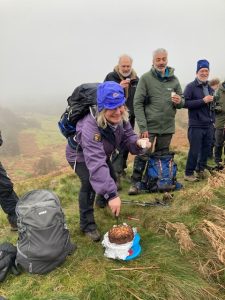
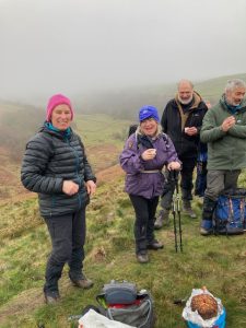
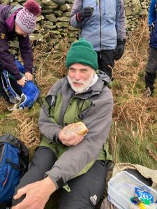
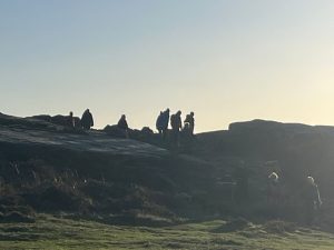
What a wonderful occasion! Chris Kell’s 70th birthday!.
Boosted by many wishing to celebrate with Chris, our departing number amounted to
23.
Weather wise it was the calm before the expected snow storm as we set off under an overcast sky. Ground conditions were really icy after a hard frost with one of our number finding the going easy wearing micro crampons.
So onwards and upwards out of Eyam heading towards Sir William Hill.
It was about 1.5 miles into our walk that the leader decided to practice his long abandoned acrobatic skills by apparently doing a spectacular backward roll whilst descending a stile. After being kindly checked over we then all proceeded to the trig point for a group photo. A descent followed to path junctions at GR:- 214788 where Chris cut her birthday cake and Ali & Andrew provided us with various alcoholic drinks to celebrate.
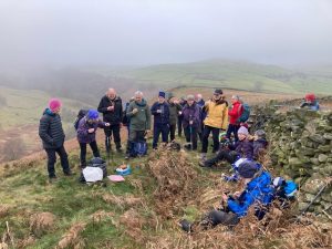
Rosy & Andy then departed for a shorter walk – the rest of us continued on to Stoke Ford where Geoff joined us after his very early ascent of Grindsbrook.
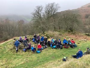
Lunch shortly after at some old mine buildings at the start of Bretton Clough where old walls provided seating.
From here it was quite a pull up to Bretton Moor before we descended back to the main car park in Eyam.
Some of us then carried on the celebrations in the new cafe/restaurant ’Cupola’ in Stoney.
Many thanks to all who came. Certainly a joyous occasion with the just under 6mile route completed before the snow which came later.
Pete
 Participant
Walk Report/Statistics
Party size 8
Start time 8am – Lose Hill summit 8.53am.
Mam Nick coffee break 10am
First lunch at 1533 spot height below Swines
Back at 12.00.
Second lunch at Hartshorn 2pm
Afternoon tea at Hope Cross 3.40pm
Winn Hill summit 4.50pm
Finish at Hope Primary School 5.50pm
Distance 19.81 miles – 3471ft of ascent
Walking time 8hrs 16mins
Total time 9hrs 50 mins
Steps 46,262
Weather – light cloud mostly with some
sunny periods early afternoon.
Temperature approx at freezing level all day
Ground conditions reasonable, no ice.
Just a sprinkling of snow at Kinder Low.
Pics can be found on the Walking WhatsApp
page.
Congrats to all “Skyliners’ and a big thank you
for your company.
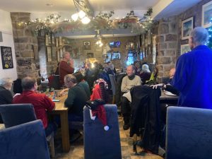
PeteParticipantBrief Walk Report
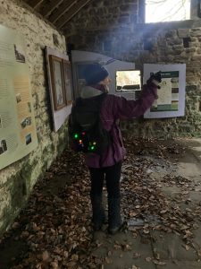
Three groups set of at staggered intervals from the Fox House. All met up at the stone building at the top of Padley Gorge where shots of Ginger Frog (Brandy & Ginger Wine) were consumed.
29 sat down for lunch at the Grouse. Excellent food as always.
Some departed back via cars, others braved the heavy rain.
Thanks to all for turning out for another very social occasion and thanks also to the other walk leaders Gordon & Colin.
Merry Christmas to all and best wishes for an excellent 2026.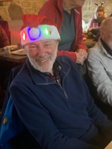

 Participant
Hi All,
Details as follows:-
Park at the Fox House roadside parking GR:-
268803 or at the Longshaw National Trust
car park at GR:- 267801.
Meet at the bus stop shelter adjacent the pub.
Please note because of the large number of us
walking (upwards of 30) we will split into 3
groups to stagger the arrival time at the pub.
Please be at the bus shelter for a start time of 10.45
First group will be led by Gordon, the second group off
at 11am led by Colin. Third group off at 11.15 led by
myself.
The route will go north east adjacent to the A6187
for 200 metres before turning north west accross to
the Burbage Valley. We then go south to our coffee stop
at the stone hut GR:- 258799. From here it’s through
the Longshaw estate to the Grouse. Return is back via the estate to the parking.
Distances – out 4 miles – back 2 miles.
The current weather forecast is light rain, 8 degrees
with a 14mph wind.
Can I ask that you pay for your meal/meals when you
enter the bar and give your name/names to the bar staff to enable them to cross you off the food list.
As usual festive clothing can be worn. I might even
turn up in a Father Christmas outfit.
Look forward to seeing you all on the day.
PeteParticipantWalk Report
21 of us set out from Curbar Gap shortly to be joined
by Marian & Kathy who had walked in from the Froggatt end of the track to join as far as the Froggatt climbing area.
Everyone was suitably wrapped up warm to
cope with the wind chill at approx-5C.
A good frozen surface, due to -3/4C overnight,
made firm going albeit one of our members
did slip over and bruised her chin.
Would suggest in future members consider taking
micro crampons in case of icy conditions.
Coffee break at Yorkshire Bridge – see photos on
WhatsApp walking.
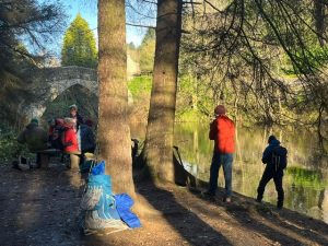
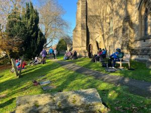
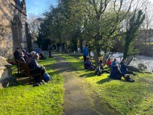
We then followed the Derwent river path which wasn’t half as muddy as I had expected due to recent heavy rain although still quite slippery in places.
Lunch taken at the back of Baslow church on the seats
facing the river. See also pics.
From here it was the long ascent to Baslow Edge
via Baslow village and then along the Edge
back to the cars. Great views along the way due
to the clear weather – see also pics.
7 miles in distance – 867ft of ascent.
Many thanks to all who came and for making a
very enjoyable winter’s walk.
Pete
 Participant
Please note the revised date of this event the 21st March has now been altered to the 28th February. This is due to a First Aid course being run on the 21st & 22nd March 2026.
Further details will follow at the end of this year.
Pete & GordonParticipantHi all,
The Night Navigation course, on the 9th
November, has been cancelled due to a
lack of support.
We will try to run this course again on
Saturday the 21st March next year so
if you’re interested please make a note
in your diary.
We’ll put a reminder note out at the end
of 2025 to get some idea of take up.
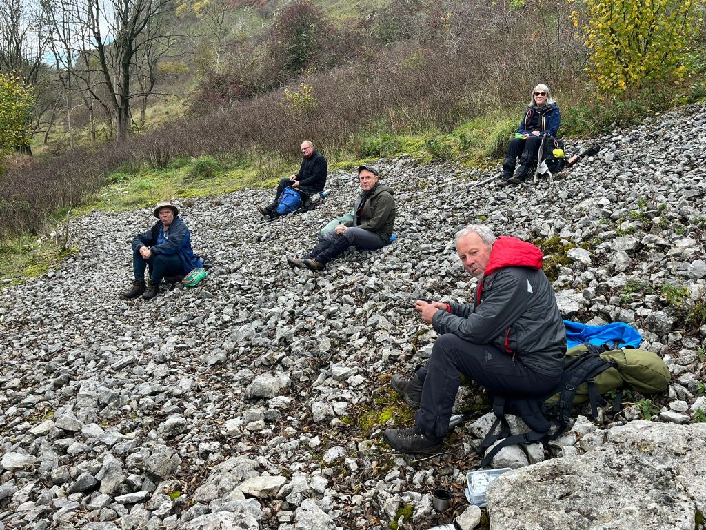
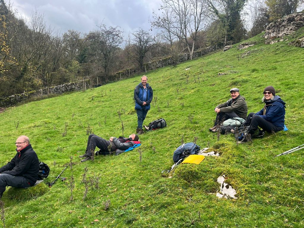
Pete & GordonParticipantWalk Report
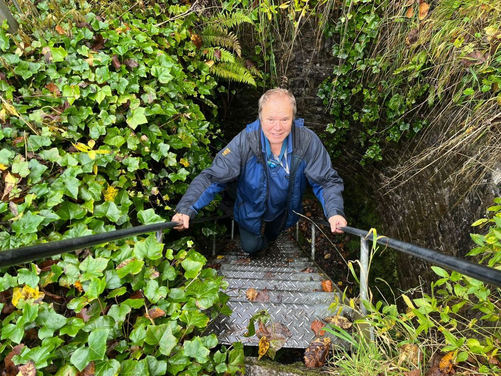
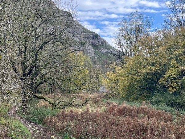
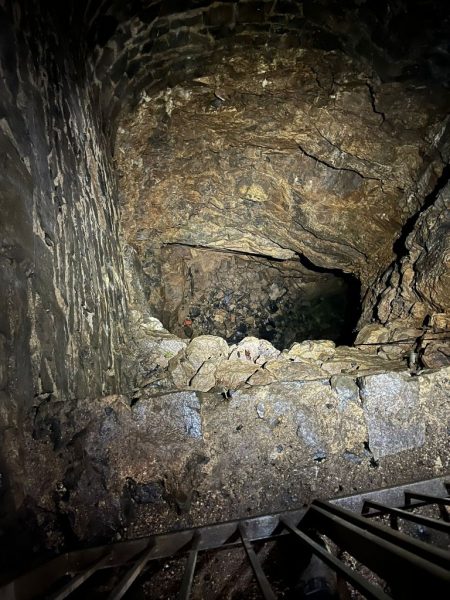
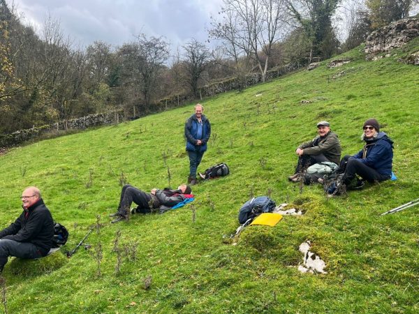
6 of us set off under clearing skies going west along
the Limestone Way. Luckily the forecast of wind and rain hadn’t materialised. We crossed a few fields before descending into Cales Dale and then turned west into
Lathkill Dale. After coffee break we had a brief exploration of the old Lead mine situated on the south
bank of the dried up river. (See pics on the Walking WhatsApp page)
Lunch was also taken in the Dale where spectacular Autumn colours abounded in all directions.
A little while after some very friendly ducks, obviously
annoyed at not being fed, took a liking to Colin’s trouser legs!🤣
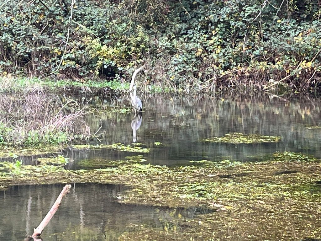
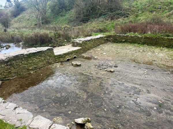
Onwards through Conksbury, then Youlgreave and into
Bradford Dale where a ‘local’ explained the river
swimming pool had become so popular, due to exposure
on social media, the Council had decided to drain it.
Apparently in the summer it had become very over
crowded with loads of litter left and areas fouled as well.
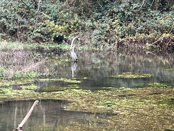
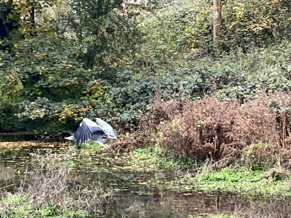
The closure had resulted in some return of wildlife which
was noted by us by then seeing a Heron. See also on the
Walking WhatsApp pics.
Our exit out of the dale was via the Limestone Way
which returned us to the cars after quite a long steep
ascent.
Distance 7.4 miles on Dick’s Sat Nav. 884 feet of ascent.
Thanks to the select 5 for joining me and your company.
Pete.


 Participant
Hi All,
So far we have 2 members who’ve shown
interest but haven’t committed to this event.
We therefore need definite confirmation of
participation by the 26th October otherwise
we will have to cancel the navigation evening.
Please respond by WhatsApp on my number
07468697805 (Pete) if you intend to attend.
Thanks.
Pete & GordonParticipantWalk Report
Six of us set off from Taddington School descending
down Long Lane Track. At the bottom we crossed the
B6049 taking the path down to the Monsal Trail.
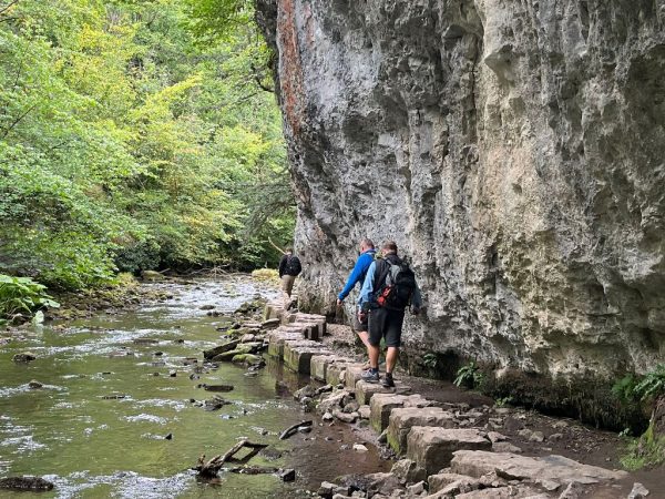
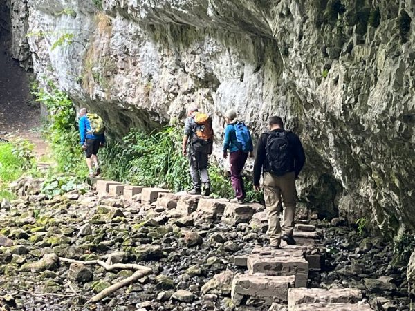
It was then down again to the River Wye where we
turned west along Chee Dale.
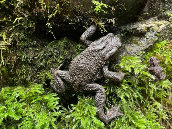
We noticed climbers on both sides of the river
some doing the hard bolted routes on the north side.
We also spotted dippers and trout in the river. A lack
of water meant a very dry route across the two sets
of stepping stones as can be seen in the pics posted on
the WhatsApp group page. Also of note was the very
polished limestone steps on the two path descents.
It would have been somewhat lethal had they been wet!
To coincide with Charles Knowles funeral at 1pm we had a two minutes silence in his memory on a bridge over the Monsal trail just up from the bike store/cafe near
Mosley Farm.
We then had lunch just above the bridge taking advantage of a good supply of blackberries.
It was then up the Pennine bridle way to Blackwell and
back over the A6 before taking tracks/paths to Sough
Top (another Ethel?). Great views were had before the
descent back to Taddington.
Just under 8 miles and 981 feet of ascent.
Thanks to the 5 that joined me.
Pete
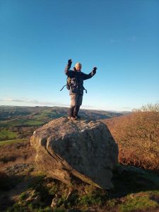
Pete’s pics
Teri’s pic
 Participant
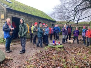
Walk Report
27 of us set off on Andy’s 80th birthday walk
from Hope Primary School. Due to pressures of
organising the evening event Andy & Rosy just joined us for the first 30minutes. Great to have had them along for part of the walk.
Coffee break was taken just above Upper Fulwood Farm
before the steep ascent to the Roman Road which runs
just below the long ridge up to Win Hill. Lunch consumed by the “kissing gate” where the track levels out not far from the summit. Easy ground the followed to Win Hill where a group pic managed to tweeze all 25 of us in. We also waved to Andy & Rosy at home in Bradwell who managed to spy us on binoculars!
Everyone then took the steep descent to Twitchill Farm
in their stride and then on to our starting point at the school. Great to see so many Castle members plus members of Andy’s family. A very pleasant walk on a lovely summer’s day.
Pics on the walking WhatsApp page.
PeteLinda’s pic

Pete’s pics


 Participant
Walk Report
9 of us left from Hope Primary School.
Breezy & overcast conditions meant we didn’t
overheat on the ascent of Lose Hill. Here we had
a quick drinks break before taking the ridge to
Mam Tor where one of our party departed.
Coffee etc. taken at Mam Nick. Ascent of Rushup
Edge & Brown Knoll followed with the weather
still in our favour. We then climbed up to the trig
point at Kinder Low, our high point of the day. It
was then on to the large rock outcrop before the
Wool Packs where we took a welcomed break for
lunch. Our route through the Wool Packs peat bog
was remarkably easy due to the very dry conditions of late. We were the blessed with enjoyable sunshine
all the way round the rest of the Northern skyline
where a good pace was set on the reasonably level
terrain. Early afternoon tea was consumed at the end
of the ridge before the descent to Hope Cross.
From here the long haul up to Win Hill followed then the descent back to Hope via Twitchill Farm.
Reasonably busy on the whole route apart from the
Rushup Edge to Brown Knoll & Ringing Roger to Win
Hill sections.
19.63 miles – 3457ft of ascent – walking time of 7hours
48 mins. Average pace 2.5mph.
A traditional pint in the Old Hall Hotel followed – much
appreciated by all.
Many thanks to my fellow “Skyliners” A grand day
out and definitely a “good craic”
PS Pics on the Walking WhatsApp page.ParticipantDetails of route:-
From Hope Primary School we take various footpaths
and roads in a NNW direction passing a hotel at
GR:- 165850. We then continue in a Northerly & NW
direction to Bagshaw Bridge. From here it’s uphill to
the spot height 314 GR:- 165868 where we pick up the main path to Win Hill.
Descent is via Twitchill Farm GR;- 177846.
Note the ascent is steep after Bagshaw Bridge plus the descent is steep down to Twitchill Farm.
See you tomorrow.
PeteParticipantWalk Report
Seven of us left from our house proceeding over fields to Stubbing Pond and then on through woods to Stubbing nature reserve. We then passed the large chicken farm complex at Gorsey Place and ascended up to Stan Edge Farm where we had coffee. Afterwards a reasonably steep climb took us over the busy Chesterfield-Matlock road, through the pleasant Stone Edge Plantation woods, and over Stone Edge golf course. Luckily we were in sight of the golfers so no flying balls to dodge! A solitary duckling scooted across the golf course pond as we walked by. No doubt the rest of the brood had been killed by other wildlife. It was then down through Gladwin Woods, passing two enormous beech trees, to arrive at Holymoorside Lake our lunch break stop. Journey back started uphill to Bage Hill Farm before
encountering a very frisky heard of bullocks which looked quite threatening. Luckily they ran away from us! It was now over to Walton Lodge Farm then crossing the Matlock Road again before a brief climb up to Harper Hill. Again we encountered over friendly wildlife in the form of horses which hurried us along somewhat. No further hazards came our way so on return to our house we took advantage of the fine weather to indulge in afternoon tea, in the garden, with various yummies consumed.
Walk distance:- just over 8 miles with 1112ft of ascent, any thanks to all who came and for your generous contribution of cake etc.
Pete

Coffee at Stanedge Farm
Duckling Stanedge Golf Course pond
Large beech tree on descent to Holymoorside
Lunch at Holymoorside Lake
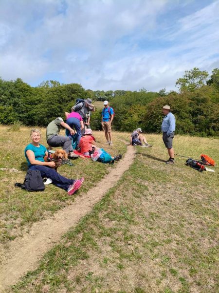
Afternoon Tea at Pete & Jane’sParticipantBrief Walk Report
14 of us started out from Hope Primary School in nice spring sunshine. Coffee break on the summit of Lose Hill. Great Ridge conditions very good and firm underfoot. Lunch at Hollins Cross.
Very busy on Mam Tor with a huge school party luckily going in the opposite direction.
Return to Hope via Blue John Mine, Treakcliff Cavern, Castleton and across fields back. Most then enjoyed tea and “stickies” after we managed to persuade a local cafe to stay open.
Distance 8 miles – 1662 feet of ascent.
Thanks to all who came and for your company.
Pete


-
AuthorPosts