Forum Replies Created
-
AuthorPosts
-
Dick Murton
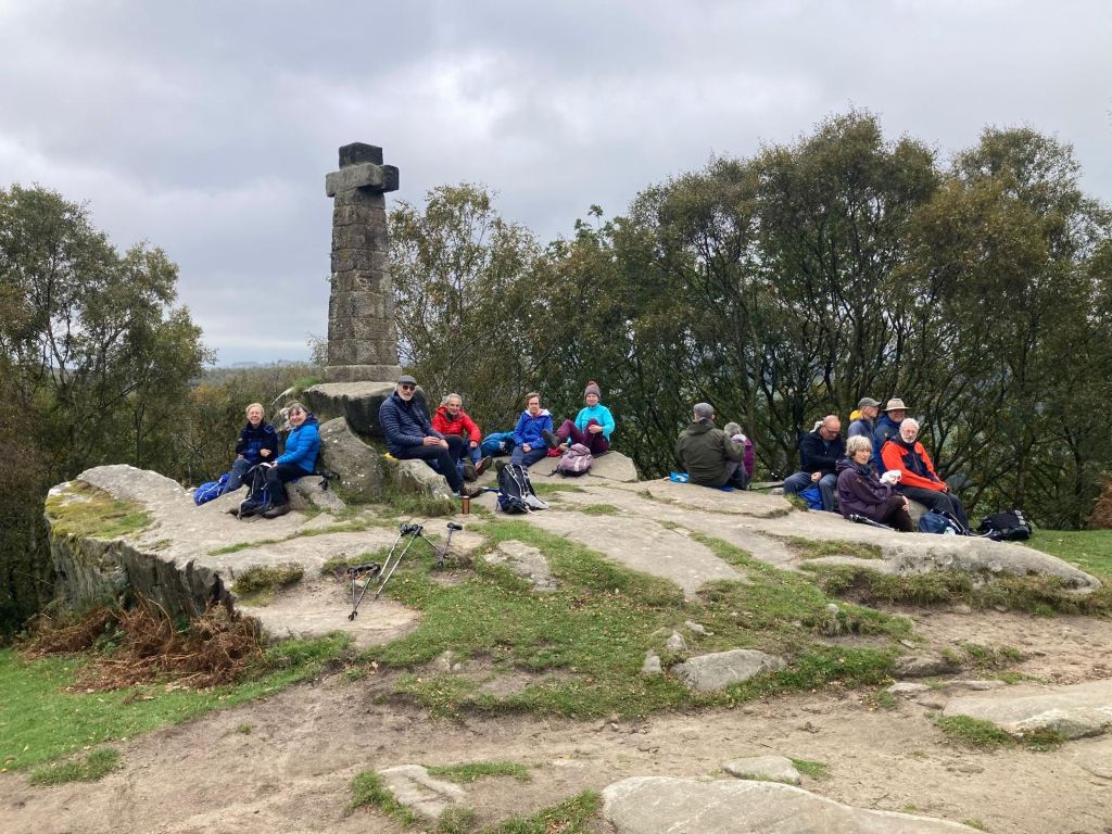
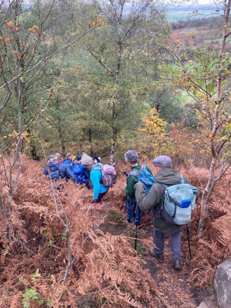
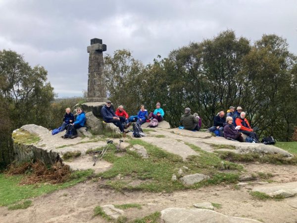
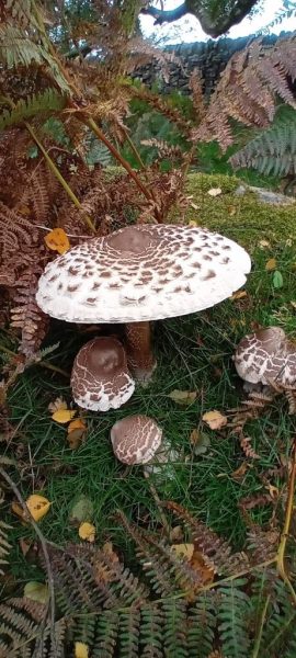
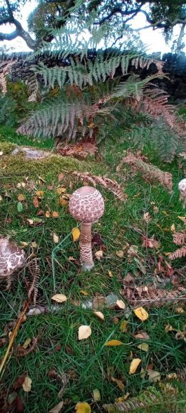
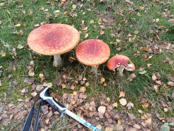
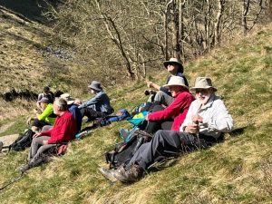
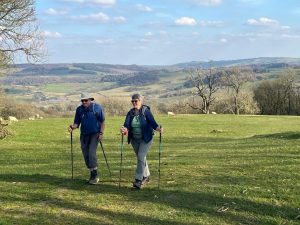
Participant15 members enjoyed (I hope) a fairly short walk, in dry but surprisingly chilly conditions. We waited a couple of minutes for yet another large group (37! this time!) to clear the gate at the crossroads, giving time for the two slight latecomers to join us. Over Birchens, and past Nelsons monument on only very slightly boggy ground, with coffee taken a little late once we got clear of the worst of the traffic noise near the Robin Hood. Several short stops to admire the plentiful fungi (see pics on WhatsApp – thanks Ali & Bron) before rising up to Wellingtons Monument on Baslow edge, either taking the longer more gentle ascent, or more direct up the steeper hillside. Lunch was a bit late at the monument, (but who wants to sit in the trees with that as an alternative?), followed by a demonstration of hand free standing up from an execution position (how else to describe it?) and headstands for a bit of light entertainment. The return was a loop round Baslow Edge and up towards White Edge, back to the cars. Thanks everyone for coming along, and a further thanks for the pictures on WA and below. A bit over 6 miles, depending on whose recording device you believe. Dick
Bron’s pics:
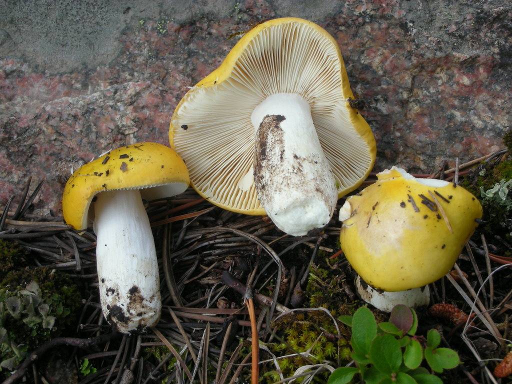
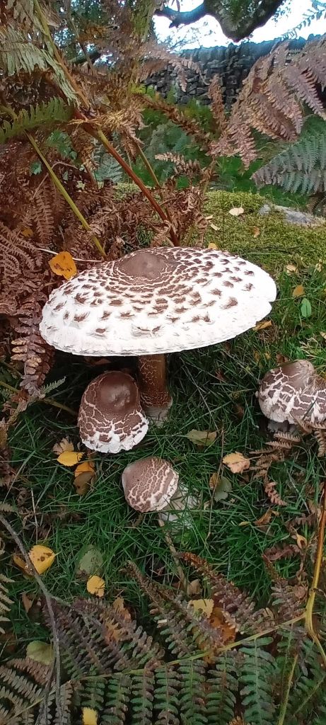
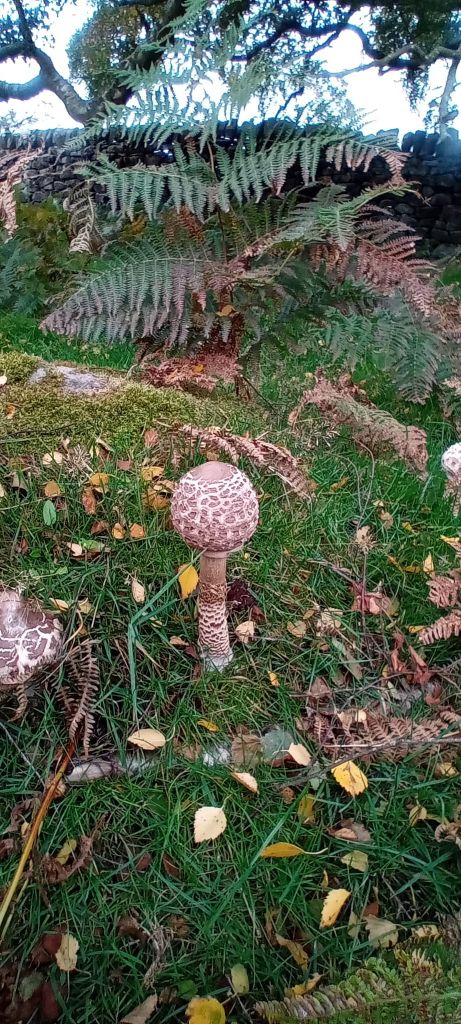
Ali’s pics (yellow swamp brittlegill, parasol fungi):

Vanda’s pic:
 Participant
Linacre is a regular dog walk, but must be on lead for upper reservoir section, assuming we are going up there.
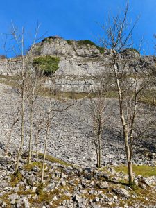
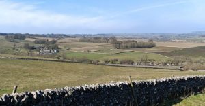
ParticipantThe earlier start turned out to be completely unnecessary after all. 8 met in a virtually empty carpark, following the road up towards Endcliffe quarry, Lees Cross quarries and then round the edge to the Earl Grey tower, where we had a short tea break, before continuing round to Birchover and up to Birchover quarry. Lunch was taken close to the road after the anticipated spot proved to be somewhat unpleasantly vegetated and fly ridden. Then on the Corkstone, everyone turning down the opportunity to climb to the top, then the 9 ladies stone circle, before descending gently through woods, taking a quick break at the viewpoint over Haddon Hall, and then back to the cars via Congreave. The weather turned out to be far better than most of us anticipated, so a dry day after all. Thanks to Vanda for some photos. Thanks to all who joined us. Just over 7 miles.
Vanda’s pics:


 Participant
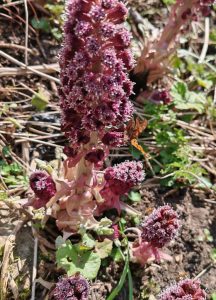
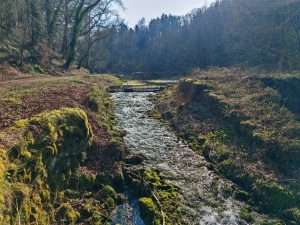
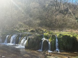
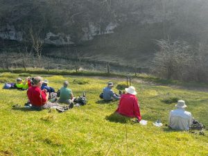
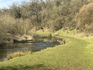
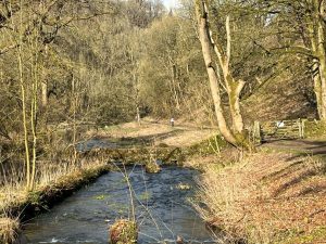
The sun god Ra was feeling benevolent today, so in sun and warmth, 4 met up in what turned out to now be a pay & display, with the other 4 parking at the nearby free layby! Setting off towards Lathkill Dale, we were followed by at least three other couples, making it look as if it was going to be an overpopulated walk. Coffee was taken at the junction of Cales Dale and Lathkill Dale, fortunately early enough to finish just after a large school group from Leicester stopped there for lunch. We continued down Lathkill Dale, to Raper bridge and then to Youlgr(e)ave. Brimstone and Red Admiral butterflies were noted out in force. A loo stop for a few, and then down into Bradford Dale, returning to the cars via Weadlow lane and paths. Distance? Somewhere a bit over 7 miles with about 1000 ft ascent. It is interesting how different models of GPS and the associated logging setup can make such a difference to the distance logged. Everyone had a different distance, and presumably ascent/descent. Thanks everyone for very pleasant day out.
Dave’s pics:
Pete’s pics:
 Participant
The sun god Ra was feeling benevolent today, so in sun and warmth, 4 met up in what turned out to now be a pay & display, with the other 4 parking at the nearby free layby! Setting off towards Lathkill Dale, we were followed by at least three other couples, making it look as if it was going to be an overpopulated walk. Coffee was taken at the junction of Cales Dale and Lathkill Dale, fortunately early enough to finish just after a large school group from Leicester stopped there for lunch. We continued down Lathkill Dale, to Raper bridge and then to Youlgr(e)ave. A loo stop for a few, and then down into Bradford Dale, returning to the cars via Weadlow lane and paths. Distance? Somewhere a bit over 7 miles with about 1000 ft ascent. It is interesting how different models of GPS and the associated logging setup can make such a difference to the distance logged. Everyone had a different distance, and presumably ascent/descent. Thanks everyone for very pleasant day out.
ParticipantA group of six braved the usual traffic chaos in Youlgreave, and potential rain showers forecast for later during the walk. A gentle descent led into a quiet section of Bradford Dale before climbing up towards Elton. The bogs were smelly as ever although not quite so extensive as expected. Apart from a brief but heavy shower we had good weather and views, proceeding at a good pace to a finish in the slightly busier part of Bradford Dale. Despondency crept in when we realised that the YHA cafe had closed but an observant member spotted a sign to the bakery where excellent cakes were enjoyed.
February 18, 2024 at 1:00 pm in reply to: Early Warning! Northumberland Meet Spring Bank Holiday 24th – 27th May #21963ParticipantWe have now booked in to both the May bank holiday weekend meets. We are going up a few days early for both of them with the intention of some cycling on quieter roads than at the weekends.
Participant9 brave / desperate / foolhardy / (insert own description here) people met in light rain and unpromising conditions at the carpark near Rowsley playing fields. No correct that, definitely a foolhardy 8 considering the organiser’s ability later on. Setting off in the rain we plodded up the hill to Congreave and through the woods toward the 9 Ladies stones circle, intending to by-pass this and visit on the way back. However, the apparently correct path more directly to the Corkstone petered out. After exploring the forest for a while, we decided to go to the 9 Ladies on a more obvious path and then on to the Corkstone for lunch, returning via the edge path which passes the Earl Grey (or Reform) Tower, and at times muddy paths back to the cars. Thanks for putting up with another attempt to lose everyone in the wilds of Derbyshire. About 7 miles.
PS, if anyone is thinking of buying a new GPS with the routable paths etc. in the UK national parks, be warned, the routes don’t always work properly even if entirely on roads or paths shown on the 1 inch map wholly within a national park.
ParticipantJust a reminder –
Because of potential parking problems as it is the school holidays, the start time has been brought forward to 10 am, in the hope of sufficient free parking spaces for us.
ParticipantThanks Kial. No problems just joining apart from needing t enable video and sound before attempting to log on.
Cheers
ParticipantKyle, Gemma, or whoever else is presenting this, please would you confirm if it is necessary to download the Teams software, or if simply clicking on “join on the web” works OK – as I suspect it does, (simply appearing to require the login details.)
Thanks
Participant12 ascended Win Hill meeting a number of D-of-E groups, not all of whom seem to have understood what is included in the countryside code – do they just leave everyone else to clear up after them at home? Or do they think there is a litter fairy? Refreshments over, time to get the poles out and down to the Ladybower reservoir. Going up to Bamford edge was a very different experience to last time I did it, lush green hid the contorted oak trees. Lunch just above the trees seemed for some to consist mainly of blueberries. The planned descent on the recently re-opened bridleway was thwarted by yet another maintenance closure, so the alternative, slightly longer route down the road and back across fields was taken instead. About 7.5 miles, in generally improving weather depending on whose GPS system you believe! Thanks everyone, including the good weather fairy.
ParticipantNo problem. Shall I drop it off, or do you want to come round and pick it up?
ParticipantUpdate on Thursday walk details. Meet at, and if space, park at GR SK 256 656, else park in community playing fields parking along road at 254 655. Up onto Stanton Moor, depending on who comes / want to do which distance along to Birchover (8.8 miles) or shorter versions avoiding Upper Town (about 7 miles), or even avoiding Upper Town and Birchover – about 6.5 miles. There are options to do shorter versions taking in the stone circle earlier in the walk. Tea and buns in cafe at mill afterwards?
ParticipantCMC Slide show
Time: Feb 3, 2022 8:00 PM London time (mainly for the benefit of those in Spain!)Join Zoom Meeting
https://us02web.zoom.us/j/87990785598?pwd=RENmK2V0M2RGVmVreEQxRkh2aHVKdz09Meeting ID: 879 9078 5598
Passcode: As found on the Castle Club website, members page. Please do not pass on to non members.Please contact me directly if you need telephone access, either from UK or elsewhere, and I will pass on the details.
-
AuthorPosts